
Want to tour Toronto like a local? Hop on a bike—rentals abound, by the hour or by the day—and cycle our bike routes, trails and designated street lanes. Here are some of our faves.
Toronto’s Waterfront Trail
You’ll still hear Torontonians refer to the Waterfront Trail by its former name, the Goodman Trail. There are basically three sections of the Waterfront Trail: Etobicoke in the west, Scarborough in the east and Toronto, which forms the central part of the trail through Harbourfront and along Queen’s Quay, where you’ll find the newly-minted two-way bike lane.
For first-time visitors to Toronto, or locals hosting out-of-town cyclists who want to see some of our highlights, I recommend that you start near York or Queen’s Quay Terminal at Harbourfront and head west. This waterfront route will enable you to visit the Music Garden, Sunnyside Pavilion and Ontario Place, to name a few sites.
This route is also ideal if you want to include concerts, art exhibits and cultural festivals at Harbourfront Centre as part of your urban biking adventure. Check out the Harbourfront Centre calendar of events and schedule your bike ride accordingly.
Suitable for: Cyclists of all levels.
Best Instagram moment: Sunnyside Pavilion – it’s an iconic Toronto landmark.
Take a break and treat yourself: Boxcar Social is a casual place to stop, rest your legs and fuel up.
Tommy Thompson Park (a.k.a. Leslie Street Spit)
The 5-km long peninsula – within minutes of downtown Toronto – is a surprise to many Toronto visitors. There are lagoons, bird sanctuaries, coves, wetlands, ponds, wildlife preservation projects, note-worthy examples of land reclamation – and a bona fide lighthouse. Best of all, the (mostly) paved route is car-free!
Tommy Thompson Park holds special appeal for bird-watchers: In 2000, the park was declared a Globally Significant Important Bird Area by BirdLife International.
The newly-built visitors’ centre occasionally hosts photo exhibits that capture the Leslie Street Spit throughout its 40-year development. Find Tommy Thompson Park details and hours.
Suitable for: Beginner riders, novices or folks who just want to enjoy a leisurely bike ride in a green urban setting.
Best Instagram moment: The lighthouse at the end of the Leslie Street Spit.
Take a break and treat yourself: Noshing options are scarce right at the Spit. There’s typically a soda and hot-dog cart at the park entrance at Unwin and Leslie Street. However, if you cycle about 10 minutes west to Cherry Beach, you’ll find a couple of food trucks during spring, summer and fall, plus local fave Cherry St. Bar-Be-Cue.
Toronto Islands
You can rent bikes on the island near the Centre Island ferry stop or take yours over on one of the three ferries (Ward’s, Centre Island or Hanlan’s Point). I recommend heading to the islands earlier in the day on the Hanlan’s ferry and cycling the entire length of the island (which is actually a cluster of small islands) to Ward’s Island.
Suitable for: All ages and levels of cycling ability, and for those looking for a car-free cycling route.
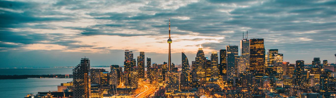
Best Instagram moment: on the pier at Centre Island or on the return ferry ride gives you the coolest view of the Toronto skyline.
Take a break and treat yourself: For a sit-down meal, head to The Riviera at Ward’s Island.
Bluffers Park, Scarborough Bluffs
Give your calves a good work-out! Seasoned riders – or those with energy to burn – can head down Kingston Road and onto Brimley Road south to Bluffers Park, at the foot of the Scarborough Bluffs.
Just be aware: What goes down must come up. The Scarborough Bluffs stretch for almost 15 km along the shoreline of Lake Ontario, east of the Toronto Beaches. The views from your vantage point 65 metres above the shoreline are Pinterest-worthy. Down in Bluffers Park you’ll find lagoons, parklands, a marina, ducks, geese and swans.
Suitable for: Experienced cyclists, especially if you’re intent on biking back up the hill.
Best Instagram moment: The top of the Scarborough Bluffs.
Take a break and treat yourself: Chow down on a full meal at Bluffers Park Restaurant or opt for a lighter snack and a drink at the more casual Dogfish Pub.
Humber Valley Trail
Your only conundrum when you descend to the Humber Valley Trail from the Old Mill, off Bloor Street West, is whether you want to head north or south. Both routes are scenic and relaxing.
Start near the Old Mill subway stop, where you can cycle or walk your bike down by the historic Old Mill Inn and Restaurant, the eye-catching Tudor-style edifice built in 1914. The southerly route (paved, of course) from the Old Mill winds through parklands and some marshy areas and you’ll eventually arrive at the shores of Lake Ontario.
Suitable for: All levels. Advanced riders can clock 56 km in total if they cycle the entire northerly route from the Old Mill to Etobicoke and back again.
Best Instagram moment: Fishing enthusiasts along the Humber River are always photogenic.
Take a break and treat yourself: The Good Fork Restaurant near Jane and Bloor for a “Toronnah” (eggs benedict with smoked salmon and dill).
Don Valley Bike Path
I’m tempted to say “paths” as there are various off-shoots from the main north-south bike path in the Don Valley, much of it running alongside the Don River. Numerous entry points make this an appealing cycling option – away from traffic – that shows cyclists the greener side of Toronto. Access points include Taylor Creek Park, E. T. Seton Park, Coxwell Ravine Park, Riverdale Park (East and West) and the Queen Street Bridge at Bayview.
My favourite route starts at the pedestrian bridge that crosses over Bayview Avenue and the Don Valley Parkway, linking Riverdale Park East (just north of the Old Don Jail) to Riverdale Park West, where visitors can stop at historic Riverdale Farm.
Descend the pedestrian bridge to the path and head north, where riders will eventually find their way to the Sunnybrook Riding Stables or Taylor Creek Park. The path bisects meadows, courses along the river bank, and winds through hectares of parkland and picnic areas.
Suitable for: All levels. More experienced riders can easily spend three hours or more cycling the Don Valley Trail.
Best Instagram moment: It’s a toss-up between some of the meadows filled with wildflowers at the height of summer – or the funky graffiti beneath the bridges.
Take a break and treat yourself: Should you end up at Riverdale Park East, there’s the Rooster Coffeehouse on Broadview (across from the Park). Cyclists can park their bikes outside. Indoor and outdoor seating.
If you end up at Riverdale Park West, there’s the iconic Jet Fuel Café on Parliament Street which caters to bike couriers as well as neighbourhood moms and students.
Kay Gardiner Beltline
This flat route follows a former railway line so it makes for an easy, leisurely bike ride. Cyclists share the route (mostly on packed earth, some gravel) with joggers, walkers and strollers. Speed limits are posted for cyclists.
I particularly like the easy ride from the access point east of Yonge Street at Merton and Mount Pleasant, just adjacent to the Mount Pleasant Cemetery, which then heads west over the railway-turned-pedestrian bridge at Yonge Street, and then on a diagonal path – mostly encased by shady trees — through Forest Hill and all the way toward Allen Road. You’ll end up just north of Eglinton West subway station.
This easy ride (Kay Gardiner Beltline route map) will only take 30 to 45 minutes or so, which means you can easily turn around and head back to your starting point near Merton Street.
Suitable for: Families with children and cyclists of all levels.
Best Instagram moment: The metal Iron Horse Sculptures have returned to the refurbished bridge over Yonge Street (just south of Davisville). The 12 life-sized silhouettes of horses positioned on the former defunct Railroad Bridge make for excellent photos and selfies.
Take a break and treat yourself: The Red Lantern Pub on Merton near Mount Pleasant (several metres north of the Beltline Trail) serves all manner of pub food—including one of the best vegetarian burgers in town!
Finch Hydro Corridor Recreational Trail
The 22.5-km Finch Hydro Corridor recreational trail is a paved walking and bike path that stretches from Norfinch Drive in the west to Middlefield Road in the east.
The trail is broken into five sections which requires cyclists to deal with a few street-crossings and intersections. Notable sights along the way include the G Ross Lord reservoir dam accessible via Wilmington Avenue (near the intersection of Finch and Dufferin).
This trail isn’t graced so much with meadows and greenery as it is by the transmission towers and hydro installations, hence its name. If you like exploring cool industrial areas, this route is for you.
Suitable for: Cyclists of all levels. It’s fairly flat.
Best Instagram moments: Shots with the hydro transmission towers in the background.
Take a break and treat yourself: Ideal post-cycle (or near the end of your outing) would be What a Bagel on Dufferin. Their bagels are filling. I’d opt for the Cinnamon or Rainbow.

Where to Rent a Bike
- Wheel Excitement is an ideal bike rental outlet, especially if you are planning to cycle along the waterfront or take a bike over to Toronto Island.
- Toronto Bicycle Tours rents out assorted bicycles from hybrid to tandem.
- Download the Bike Share Toronto app to locate the nearest bike-kiosk and available bikes near you. Bike Share kiosks are located throughout the city. Be sure to bring your own helmet!
How to Find Our Bike Paths
There are myriad ways to access our city’s biking paths and these resources will help you navigate. Check out Map My Ride or the City of Toronto Bike Network map.


